UX CASE STUDY
Hiking Connect, your go-to mobile companion for outdoor enthusiasts, simplifies the hiking experience. Discover and navigate scenic trails effortlessly, share real-time trail updates, rate your experiences, and offer valuable warnings to fellow hikers all with the convenience of both online and offline functionality.
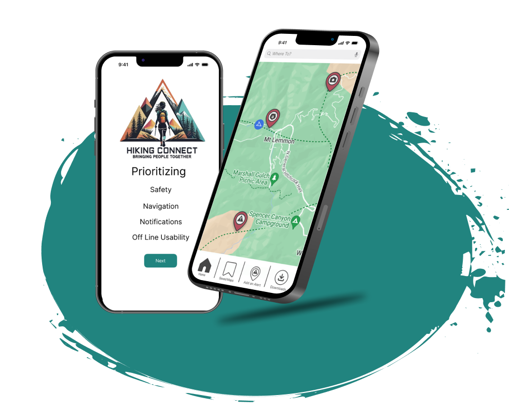
Hikers struggle with existing apps lacking real-time trail updates, information on new trails, and clear on-trail positioning. Our app aims to bridge these gaps, providing users with up-to-date conditions, new trail insights, and seamless navigation for a more informed and enjoyable hiking experience.
Empower hikers to seamlessly navigate and enhance their outdoor adventures with our mobile app, providing a user-centric experience that enables the effortless sharing of real-time information through notification pin drops. Users can download maps for offline use, ensuring uninterrupted exploration, save and revisit favorite trails, contribute valuable insights by rating trails, and easily discover new paths through an intuitive search feature. Our solution aims to foster a vibrant hiking community by simplifying trail interactions, fostering exploration, and promoting a sense of connectivity among outdoor enthusiasts.
Mitchell Harden - UX/UI & Interactive Design
Kalley Resinger - UX/UI Designer
Lilly Hoffman - UX/UI Designer
Verginia Merritt - UX/UI Designer
Mathew Cugliari - UX/UI Designer & Project Manager
Research
Interviews
User Persona
Needs, Goals
Analyze data
User insight
Problem statemen
t
Solution
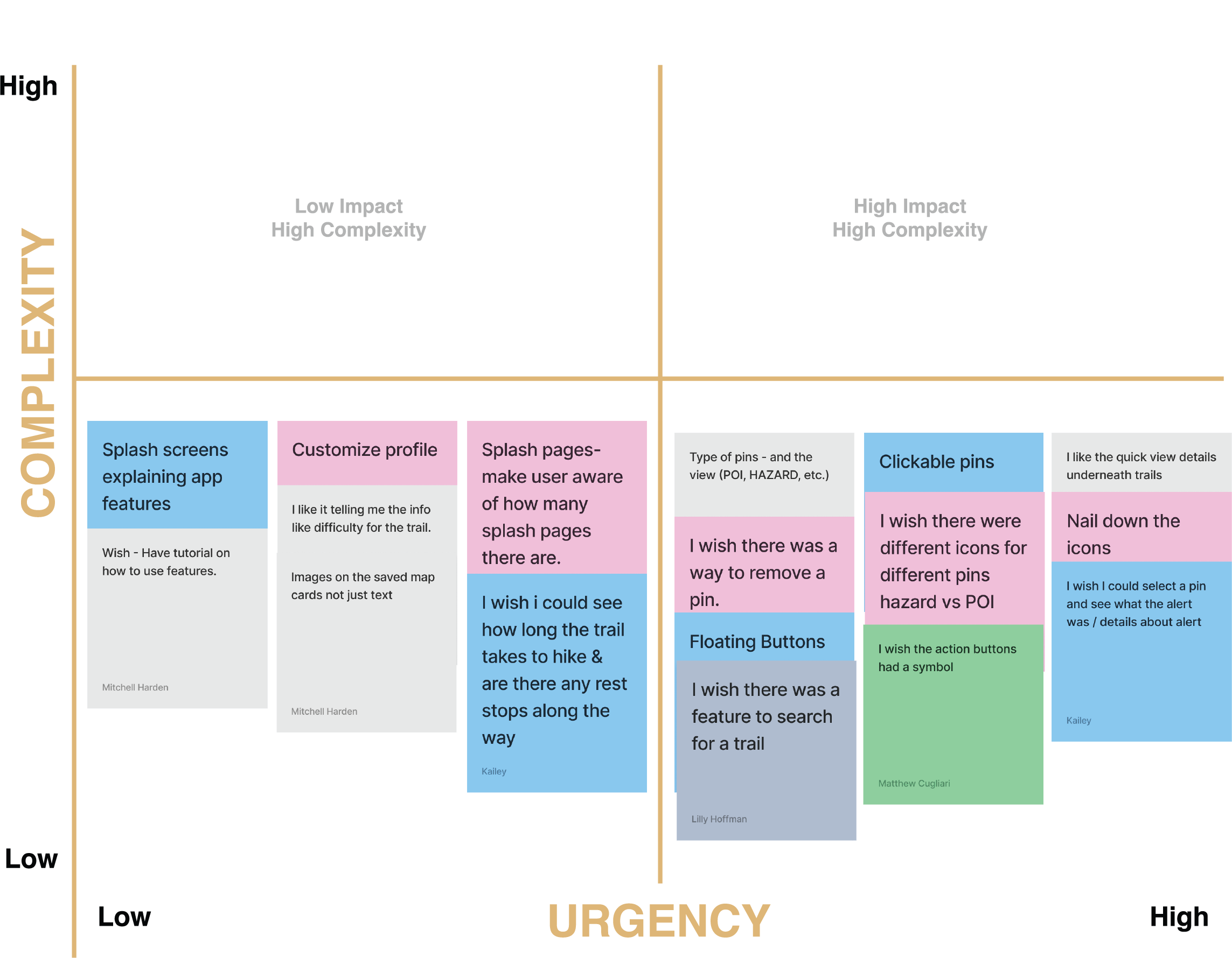
Priority Matrix
Brainstorming
User Scenario
Journey Map
Competitor Analysis
User flow
Logo
Lo fi prototype
Style guide
Color Pallet
Animations
User test
Mid fi prototype
User Test
Iteration/Redesign
Test again
Final
Ann, like many hikers, seeks up-to-date trail information for a confident and safe hiking experience. She desires a solution to track and report real-time weather conditions, addressing concerns about potential connectivity issues during hikes. Ann values the collective wisdom of fellow hikers, aiming to feel informed and secure with accurate insights, even in areas with limited network availability.
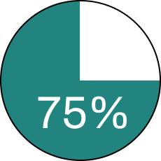
we found that 75% of users said safety features were a major priority for them in choosing an app.
75% of our users expressed a desire to be able to download and save maps for offline use.
Unexpected Hazards
Dangerous animal
sightings Bad weather
Unideal trail conditions
Loss of internet connections
Medical emergencies.
Up to date trail conditions
Warnings about the tail
Others users notifications
Planning information
Trail ratings
About
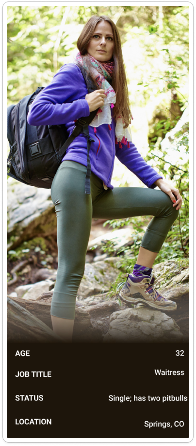
Ann is an experienced hiker who loves the outdoors. She tends to do her research on a trail before gong out to a hike and exploring. Ann isn't really the social type but appreciates the interaction among herself and other hikers. She has to pit-bulls that she adores and lives her life in solitude and independence.
Known Habits
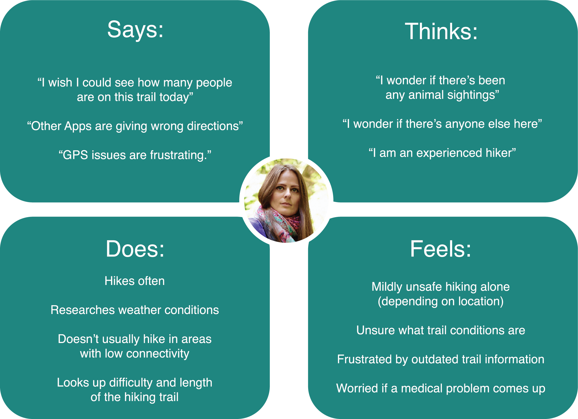
1- She tends to spend a lot of time researching hikes that are known to have low internet connectivity.
2- Prefers to hike alone but only goes to tails that she knows are actively being used by other hikers.
3- Ann Is always aware of where the nearest water station or restroom is located on her hikes.
Goals
1- To utilize and app that is easy to navigate and get the functions she wants easily.
2- ability for the app to tell her of any trail issues ahead.
3- The app to give important tail information and tracking capabilities.
Pain
1- Ann is often hiking in low internet availibity areas.
2- She often can not save or favorite her most liked trails.
3- GPS often does not track good enough or show alt routes.
Ann searches for an app to help her navigate and feel safe on her upcoming hike.
Ann downloads the Hiking Connect application.
Ann is excited to have her dogs along with her.
Ann’s dogs notice animal noises and Ann becomes worried.
Ann checks Hiking Connect to see if any animal sighings have be reported, there is one and Ann changes her route.
Ann is still out on the trail when she loses signal and gets lost.
Ann remembers she downloaded her map through Hiking Connect.
Ann navigates her way back through the trail with the downloaded map telling her where to go.
Headline 32pt
Sub Header 16pt
Body Copy 12pt
Body Copy Bold 12pt
Test our apps accessibility of our newest freature for users (easy? or confusing for the user?)
- Hikers
- Experienced and/or beginners
- Trail bikers
- People who are looking for a safety feature within a hiking app
1- Are accessing all features intuitive?
2- Can users easily download a map?
3- Can users easily see and add a new alert?
Working on this project was a rich learning experience for me. It encompassed everything from establishing a comprehensive design system to implementing interactive elements that provided clear feedback to users upon completing actions. Our primary objective was to enhance user engagement by enabling them to create personalized pin alerts, allowing fellow trail users to access and benefit from them. Whether it's to alert others of potential hazards or to share remarkable findings in nature, our aim was to facilitate seamless communication among users on the platform. Check out the Figma proto type here!